The Grey Panthers
Walks in the WEARDALE Area
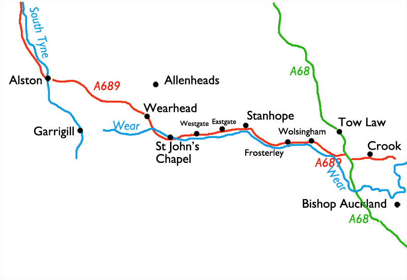
Select the image above for a larger sized map, which will help you select
one of the routes (below).
The larger sized map opens in a new window (close it to return to this page).
Press <Ctrl><P> if you want to print it.
Start From |
Route |
Distance |
||
| Alston (*) | Kirkhaugh | 7 miles | ||
| Coalcleugh | abd Carrside | 9.0 miles | ||
| Eastgate | to Rookhope & Bishop's Seat | 9.1 miles | ||
| Garrigill | to Alston along the South Tyne | 9.7 miles | ||
| Garrigill | to the Source of the South Tyne | 9.7 miles | ||
| Rookhope | to Blanchland | 12.5 miles | ||
| Stanhope | to Bollihope | 8.9 miles | ||
| |
Stanhope | to Stanhope Common and Long Hill | 10.2 miles | |
| |
Stanhope | to Shield Hurst and Eastgate | 9.3 miles | |
| Stanhope | to the Weatherhill Engine & Fell Haven | 9.8 miles | ||
| Wearhead | to Cowshill, Sedling Rake, & Daddry Shield Bridge | 9.7 miles | ||
| Westgate | to Rookhope | 9.5 miles | ||
| Wolsingham | to Frosterley | 9.6 miles | ||
| Wolsingham | to Frosterley | 9.6 miles | ||
| Wolsingham | to Tunstall Reservoir | 8.4 miles | ||
| Wolsingham | to Tunstall Reservoir | 8.0 miles | ||
(*) Note : The Alston-Kirkhaugh walk is included in the "Weardale" walks, even though Alston is in South Tynedale, purely for convenience sake.