The Grey Panthers
Walks in the NORTH YORK MOORS (EAST) Area
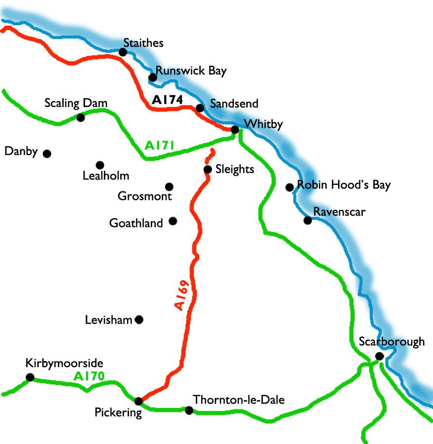
Select the image above for a larger sized map, which will help you select
one of the routes (below).
The larger sized map opens in a new window (close it to return to this page).
Press <Ctrl><P> if you want to print it.
Start From |
Route |
Distance |
||
| Danby | and Commondale via Danby Low Moor | 10.7 miles | ||
| Danby | and Houlsyke | 10.5 miles | ||
| Egton Bridge | to Beck Hole | 7.0 miles | ||
| Egton Bridge | to Sleights | 10.0 miles | ||
| Falling Foss and Sneaton High Moor | 10.2 miles | |||
| Glaisdale Village (1) | to Glaisdale Rigg and Glaisdale | 9.8 miles | ||
| Glaisdale Village (2) | to Glaisdale Rigg and Glaisdale | 9.8 miles | ||
| Goathland | to Egton Bridge and Grosmont | 10.0 miles | ||
| Goathland | to Levisham Station | 10.9 miles | ||
| Goathland | to the Lilla Cross | 10.6 miles | ||
| Goathland | to Wade's Causeway | 10.6 miles | ||
| Grosmont | to Goathland via Sheep Bield | 10.0 miles | ||
| Grosmont | to Goathland, Moorgates and Sheep Bield | 10.0 miles | ||
| Hawsker | to Robin Hood's Bay and Fylingthorpe | 10 miles | ||
| Lealholm | to Danby | 9.6 miles | ||
| Lealholm | to Egton Bridge and Egton | 9.9 miles | ||
| Lealholm | to Glaisdale Rigg | 9.8 miles | ||
| Lealholm | to Great Fryup Dale | 8.6 miles | ||
| Levisham | to Needle Point | 11.4 miles | |
|
| Littlebeck | The May Beck Valley circular | 9.0 miles | |
|
| Lockton | to the Hole of Horcum & the Bridestones | 10.4 miles | |
|
| Pickering | to Thornton-le-Dale | 9.3 miles | ||
| Robin Hood's Bay | to Ravenscar | 9.7 miles | ||
| Runswick Bay | to Goldsborough | 8.8 miles | ||
| Runswick Bay | to Ugthorpe | 9.6 miles | ||
| Sandsend | to Lythe and Whitby | 11.7 miles | ||
| Scaling Dam | to Danby | 9.0 miles | ||
| Sinnington | to Cropton and Aplleton-le-Moors | 9.1 miles | ||
| Staithes | to Hinderwell and Boulby | 11.7 miles | ||
| Staithes | to Runswick Bay | 10.8 miles | ||
| Staithes | to Skinningrove | 11.6 miles | ||
| Ugthorpe | To Mulgrave Woods and Sandsend | 9.0 miles | ||
| Whitby | To Hawsker and Stainsacre | 9.0 miles | ||
| Whitby | To High Hawsker and Sneaton | 10.6 miles | ||
| Whitby | to Sandsend | 7.2 miles | ||
| Whitby | to Staithes | 12.5 miles | ||
| Wrelton | to Pickering and Cawthorne Camp | 10.9 miles | ||