The Grey Panthers
Walks in the COUNTY DURHAM Area
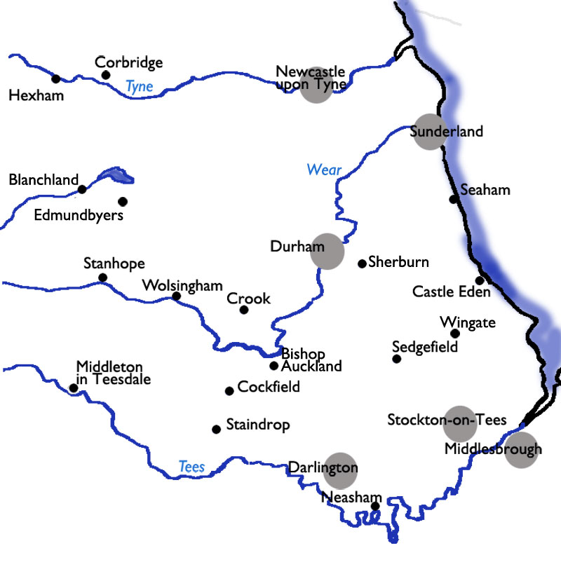
Select the image above for a larger sized map, which will help you select
one of the routes (below).
The larger sized map opens in a new window (close it to return to this page).
Press <Ctrl><P> if you want to print it.
Start From |
Route |
Distance |
||
| Baybridge | to Riddlehamhope and Blanchland | 10.3 miles | ||
| Bishop Auckland | to Bellburn Wood, Binchester, and Escomb | 10.2 miles | ||
| Brafferton | to Barmpton & Ketton Bridge | 8.6 miles | ||
| Byers Green | to Bellburn Wood & Bishop Auckland | 9.98 miles | ||
| Byers Green | to Todhills, Bishop Auckland, and Bellburn Wood | 9.8 miles | ||
| Broom Park | to Ushaw Moor and Langley Park | 9.7 miles | ||
| Castle Eden | to Blackhall | 9.7 miles | ||
| Chopwell Woods | to Lintzford Mill and Blackhall Mill | 9.2 miles | ||
| Corbridge (*) | to Halton | 10.4 miles | ||
| Derwent Valley(*) | and the Red Kite Trail | 11.3 miles | ||
| Edmundbyers | to Muggleswick | 10.4 miles | ||
| Edmundbyers | to Old Man's Grave | 8.0 miles | ||
| Escomb | to Bishop Auckland | 4.7 miles | ||
| Gaunless Valley | Cockfield and Butterknowle | 9.0 miles | ||
| Hamsterley Forest | to the Elephant Trees | 8.5 miles | ||
| Hamsterley Forest | to Neighbour Moor | 8.5 miles | ||
| Langley Park | to Esh and Quebec | 9.66 miles | ||
| Penshaw Monument | to Fatfield and North/South Hylton along the River Wear | 9.6 miles | ||
| Rowlands Gill | to Causey Arch | 11.1 miles | ||
| Seaham Harbour | to Hawthorn | 9.15 miles | ||
| Seaham Harbour | to Hawthorn Dene | 11.1 miles | ||
| Sedgefield | to Thorpe Thewles | 12.0 miles | ||
| Sherburn | to Littletown and Hetton le Hill | 9.9 miles | ||
| Sockburn Loop | from Neasham to Lower Dinsdale | 8.6 miles | ||
| Staindrop | to Winston and Little Newsham | 13.0 miles | ||
| Sunderland Bridge | to Tudhoe Village and Byers Green | 11.8 miles | ||
| Wingate | to Station Town, Hurworth Burn, and Trimdon Colliery | 9.9 miles | ||
(*) Although these walks are in Northumberland, they are just over the river from County Durham so have been included here.